Ngoc Linh Mount
The Ngoc Linh is the highest point of the Annamese Cordillera (2598 m). Although close to Danang, the Ngoc Linh is a legendary and wild massif, one of the remotest in Vietnam and peninsular Indochina. Called the Devil’s Triangle during the Vietnam War, the massif is the object of local superstitions.
On its western slope, the Ngoc Linh dominates the N14 road (the Hô Chi Minh road) and the Laotian border. To the north, it extends towards the foothills of its counterpart, the Ataouat (2500 m), the second-highest point of the Annamese Cordillera. To the east, it overlooks the Pacific Ocean and the coastal plains of Quang Ngai province, while to the south lie the Dak To Valley and the northern limits of the central highlands, north of Kontum.
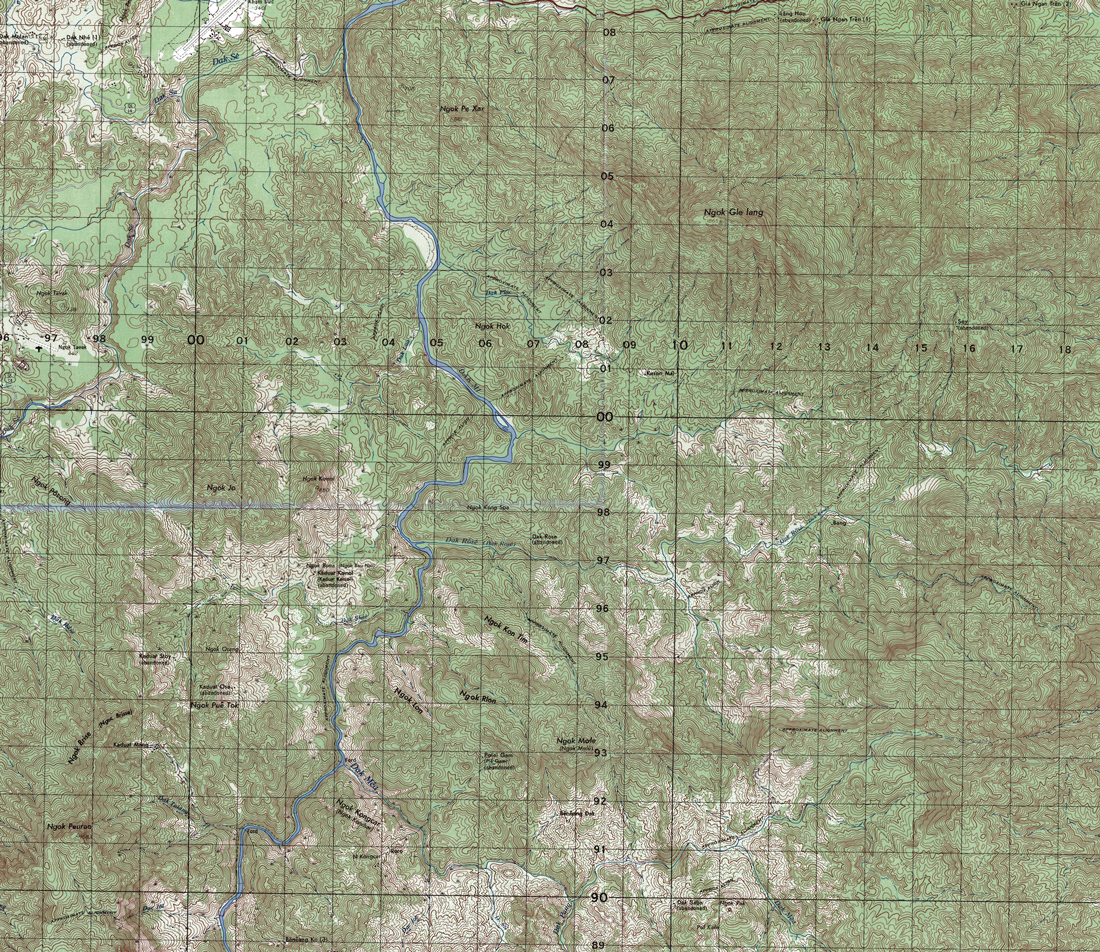
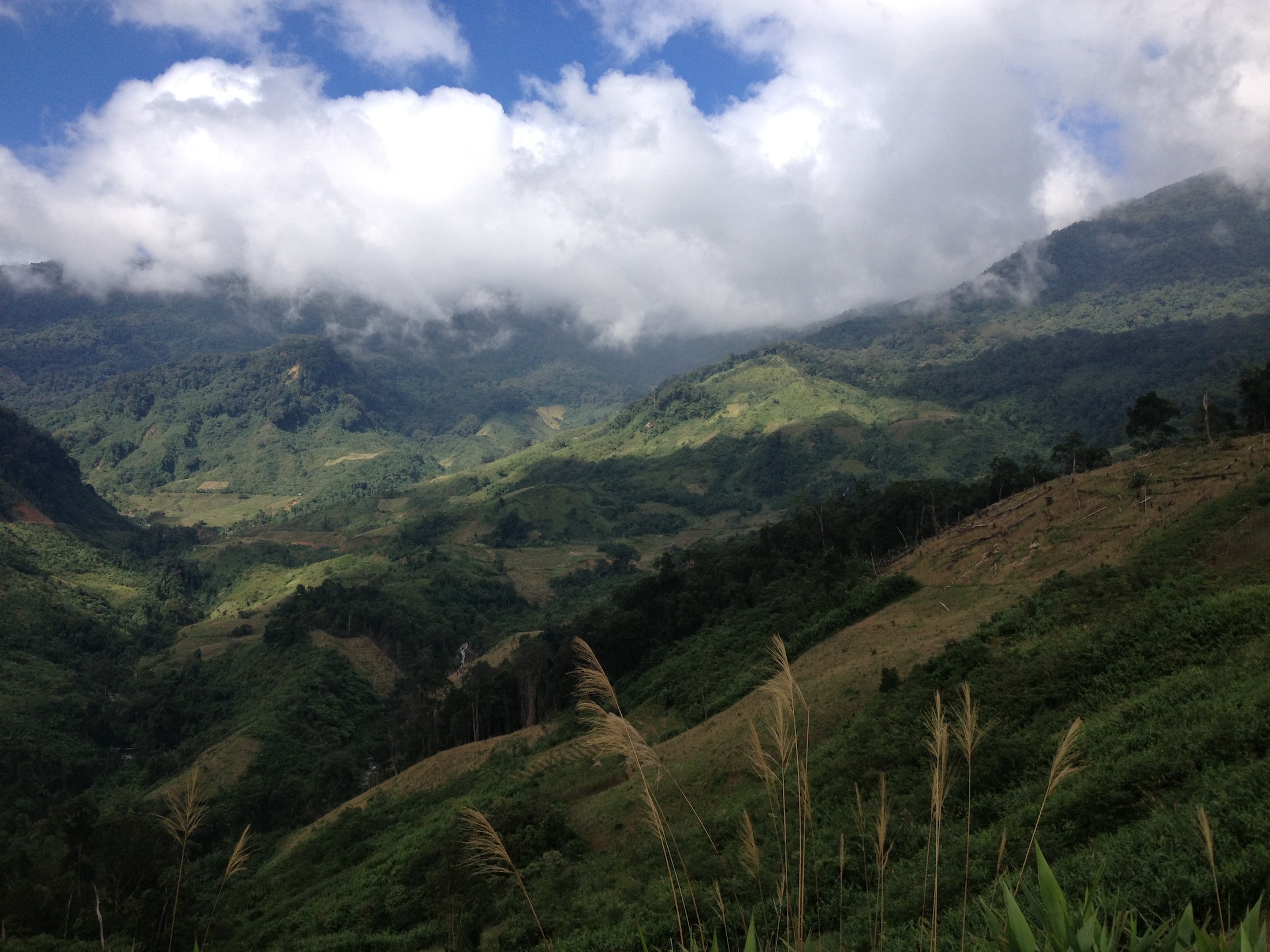
The Ngoc Linh range forms an imposing mass, with tight granite peaks running north to south and the center forming a kind of horseshoe around a central valley cut by the Dak Mek River. The northern slopes of the Ngoc Linh stretch toward the town of Kham Duc and the Ngoc Gle Glang (1865 m), a bloated, wood-covered mountain. Further south, the massif rises abruptly, appearing as a black wall formed by a set of peaks dominating the Dak Mek gorges, notably the Ngoc Pue Tok (1050 m), the Ngoc Brisse (1433 m), the Ngoc Peurao (1683 m) and the Ngoc Mele (1249 m).
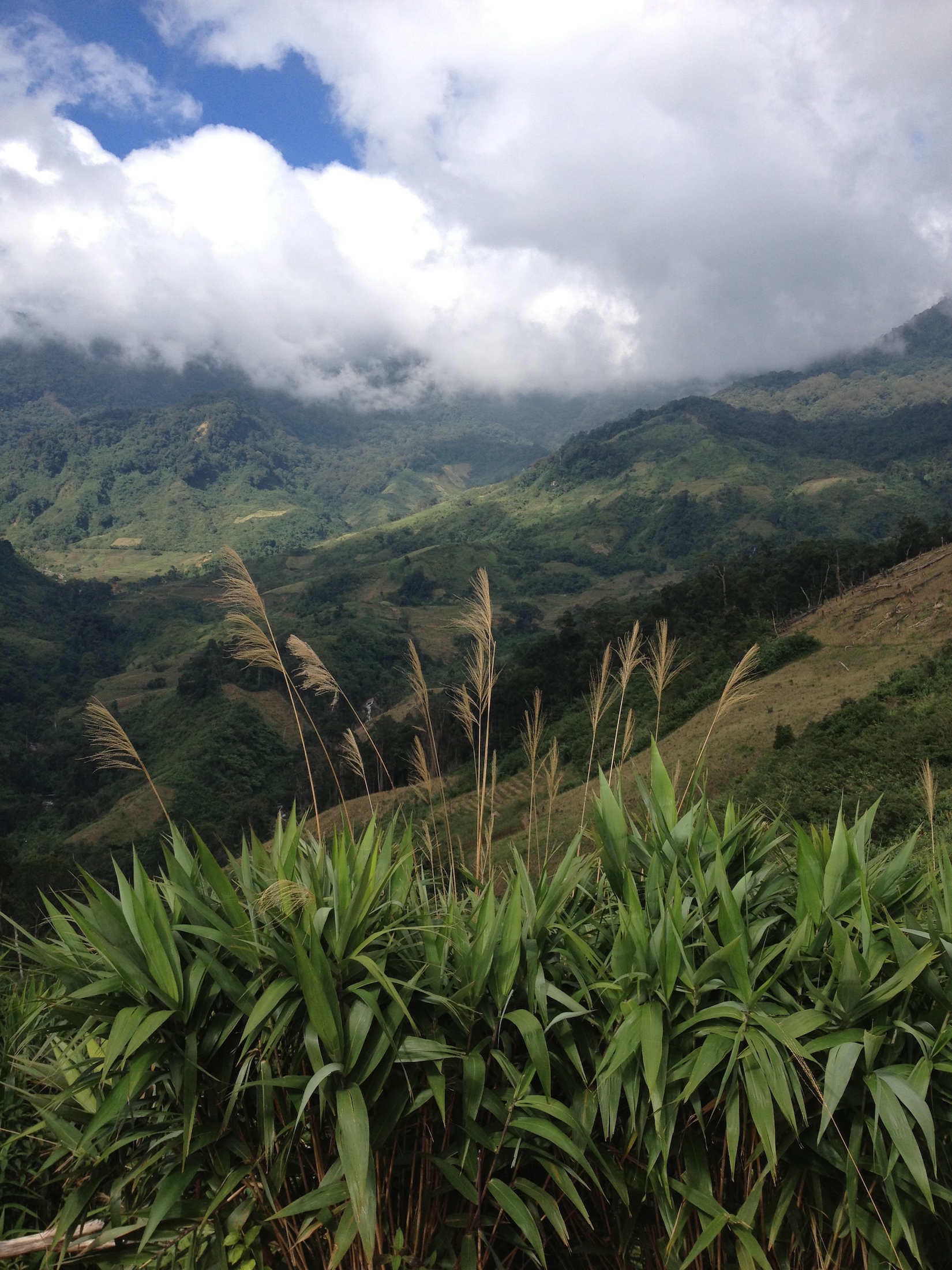
South of this black wall, the central valley of Ngoc Linh opens into a valley dominated by two high ridges with a set of imposing misty peaks, including, to the east, the highest point: the Ngoc Linh (2598 m), neighboring Mount Plésé Toum (2576 m), and Mount Kong Tan (2018 m). The western ridge is overlooked by Mount Ngoc Gleyang. Towards the east, Ngoc Linh offers dramatic views of high, misty slopes covered by forest, with foamy waters flowing down from cataracts to the Dak Di River. The southern part of the central valley is closed off by a narrow pass leading to the massif’s southernmost valley, with a long ridgeline and the dark mass of mount Ngoc Yang (2,378 meters). To the west, the Ngoc Linh falls toward the valley of the Dak Pek and Dak Poko rivers.
The complex orography of the Ngoc Linh produces many winding streams that struggle to find their way, flowing and rumbling on pebble and blunt rock beds through tortuous, steeply-cut small valleys barred by falls and rapids. During heavy monsoons, the massif’s countless springs turn into roaring waterfalls. One of its most noteworthy rivers is the Dak Mek (and its tributaries the Dak Mea, Dak Rosé, Dak Jol and Dak Duat), which becomes the Dak Mi further upstream and feeds the Song Cai, whose waters join the Pacific at Hoi An. Others include the Dak Di, which feeds the Song Tranh and also flows towards Hoi An; and the Dak Poko, which runs towards Kontum, Pleiku, and Cambodia, where it forms the Xe San together with other Daks; and the Sekong, which flows to the Mekong at the level of Stung Treng.
The Ngoc Linh is classified as a nature reserve. Biological studies conducted in the region by several institutions – including the American Museum of Natural History, the Missouri Botanical Garden, and the Institute of Ecological and Biological Resources of Vietnam – have identified 385 species of plants, 50 species of mammals, 171 varieties of birds, 15 species of reptiles, and 25 amphibians. Among the most notable are the muntjac (Muntiacus truongsonensis) and the golden-winged thrush (Garrulax ngoclinhensis).
The Ngoc Linh is populated by the Sedang (Xo Dang), a proto-Indochinese indigenous group from the Austro-Asian and North-Bahnaric language family that has existed in the region since ancient times. Their numbers are declining; in 1975 there were 400,000 Sedang, and now there are only 127,148. They are divided into sub-groups including the Hdang, Kmrang, To Dra, Ca Dong, Monam, Chau, Ta Tre and Halang. Sedang territory borders the land of the Katu, Jeh and Cua to the north, and the land of Bahnar, Rongao, Hadrong and Bahnan to the south.
To the west, it extends towards Laos and the regions of the Rengao, Halang, Alak, and to the east the lands of the Katua, Kayong, Hre, Todrah and Monom. In olden times, Sedang territory included the centers of Champa, including My Son and the coastal plains populated by Khins.
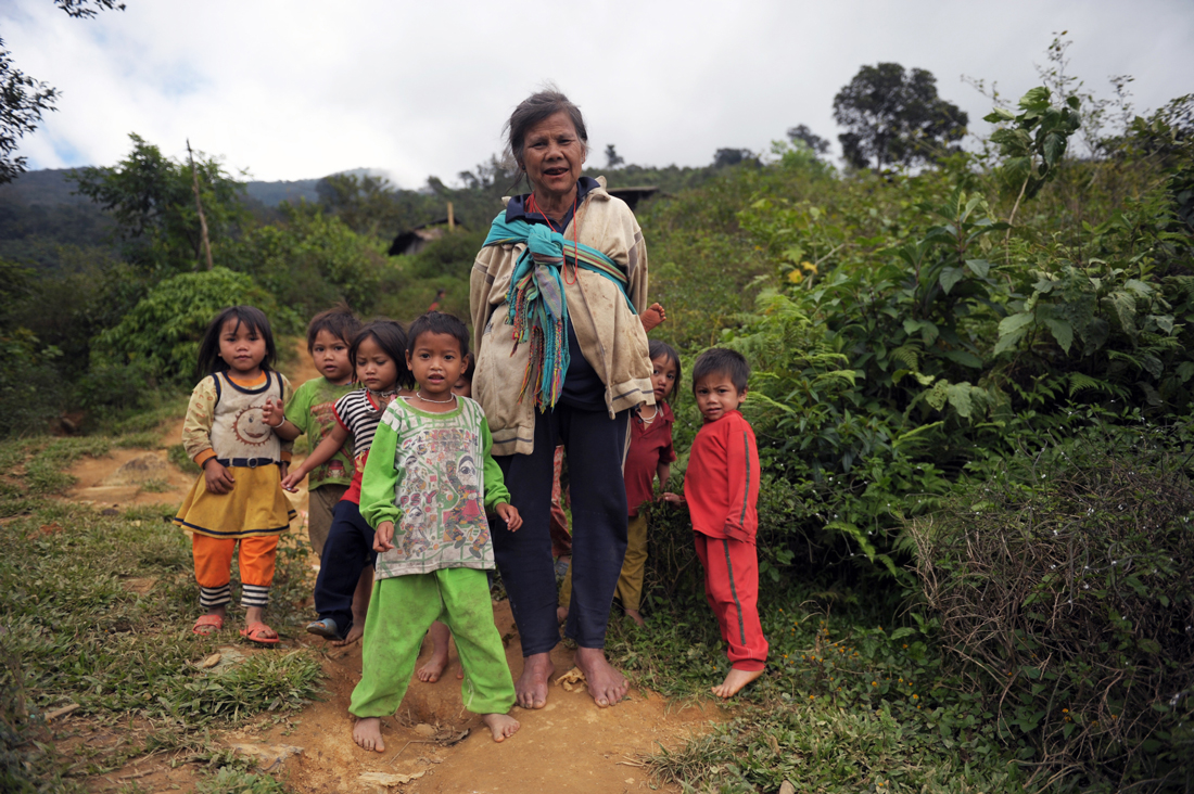
Traditionally the Sedang are nomadic and practice slash-and-burn agriculture, now prohibited and replaced by irrigated rice cultivation – a technique that can be seen on the sumptuous, rice-terraced slopes of the Ngoc Linh. The Sedang villages of the Ngoc Linh are established in the central valley or mid-slope on different areas of the massif, under the edge of the great summit-forest.
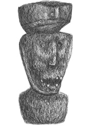
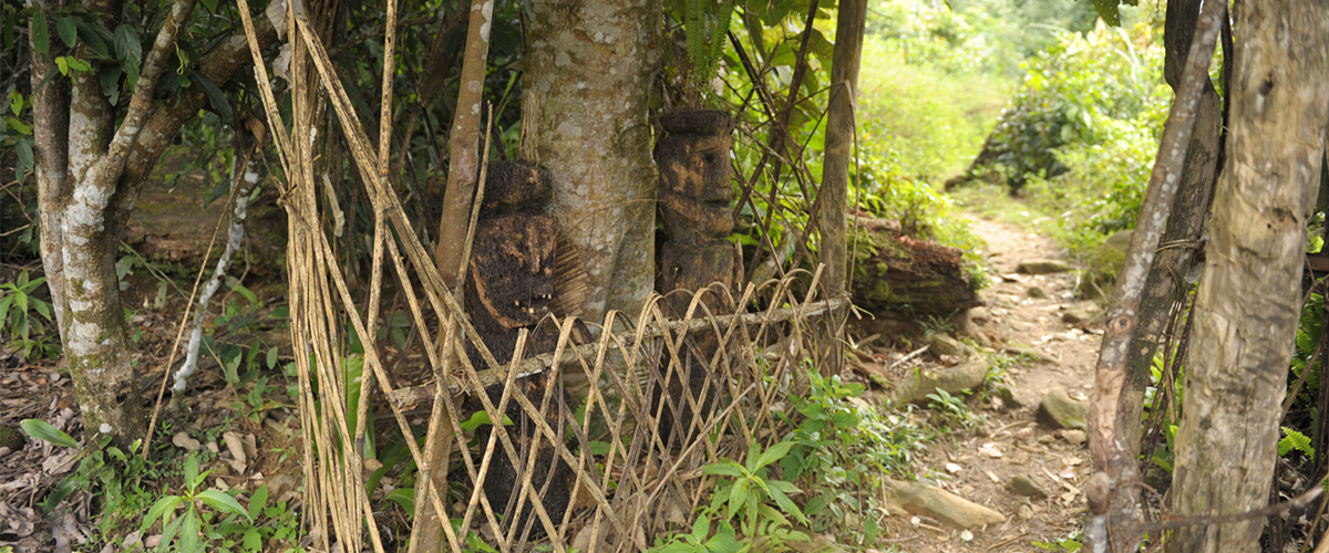
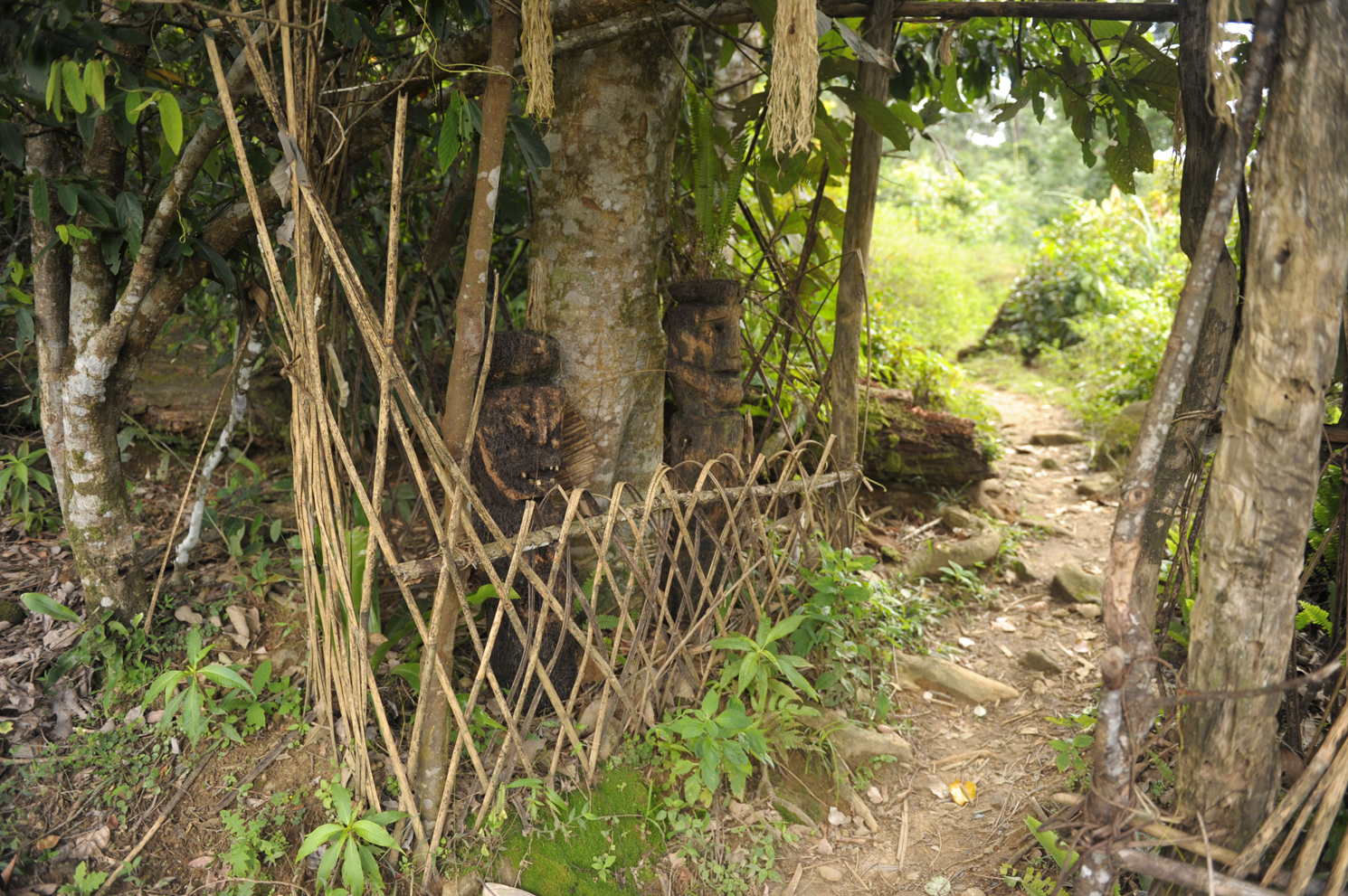
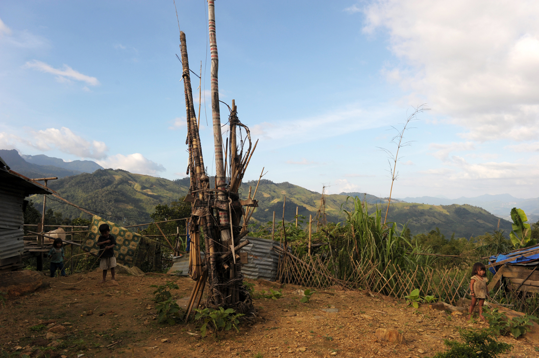
The main communities are Dak Nai, Mac Lung, Dak Rang and Tra Linh. The villages are often circular in shape, with communal houses marked by sloping roofs. The Sedang houses look tiny, like hobbit houses, with a low, almost round door that leads to the smoky, dark main room. They typically do not have windows, except for a black hole in the roof for smoke to escape and small alcoves that appear in the dark. The paths leading from the villages to the edge of the forest are often protected by frightening totem poles, with pearl eyes and covered by shiny moss.
The Sedang are originally animist and have a particular affinity to astronomy and celestial objects, especially the stars, because the high altitude of their territory allows fairly accurate observations. Some circumpolar stars are associated with sowing and harvesting cycles, for example the North Star and the Holong Konlong (literally the upstream star). The Milky Way is named Holong Nheng (the mirror stars or glass stars). Shooting stars and meteors are called Holong Eak (a defecating star), and the Tektites (Indochinites) or meteorites sometimes found in the south of the Sedang country towards Kontum are therefore approached with the utmost caution since they are considered as faeces of the stars.
The comets, called Kia Xeang (ghost-spirit), are traces left by the wake of ghosts or lizards propelling themselves into the cosmos, their sight heralding disease. Some very bright stars are called Holong Nheang, including Venus, the Holong Ga (the dawn star). The locally designated Pleiades of Todrong Chu (pig basket) are used as a calendar to define the times of sowing and harvesting. The stellar cluster of the Hyades (the constellation of the bull) is designated Toniam (the blacksmith’s forge); Orion is Ta (the spear trap, its three stars being spear-shaped); Betelgeuse, a red supergiant in Orion’s constellation, is Chiu (the barking deer); and the Southern Cross is probably Khia (the shield).
The Sedang sacrificial poles, the Loang Kang Ja Pia (literally the sacrifice totem of grandmother Pia, as Pia or Apia is a Sedang goddess, either elephant, human or flower), represent the constellation of Scorpio. The moon has several names according to its phases – hanging moon, big moon, medium moon, moon with a frog’s belly. The appearance of Kau Ka Khe (the Kau fish that eats the moon), an eclipse, is considered a bad omen. The sun designates the hours of the day: the outgoing sun, the warm, the falling, and the flooded (the setting). An eclipse is called Kdpe Ka Hai (the millipede eats the sun, a dragon among the Chinese), and during the phenomenon, the villagers suspend their fieldwork to gather, shout, scream and bang on gongs and drums to help the sun in its fight.
In the complex Sedang approach to astronomy, one can imagine their vision of mountains, forests and rivers: children of the stars and home to a multitude of geniuses, spirits and other frightening creatures. Their fears are expressed in the myths and stories surrounding Mount Ngoc Linh, the central and highest point of Sedang country. During the Vietnam War, the U.S. Air Force pilots called Ngoc Linh the Devil’s Triangle because all kinds of aircraft were shot down there. Its center was a maquis area of the North Vietnamese Army, and its surroundings the scene of many battles and former U.S. special bases, including Mang Buk and Dak To to the south and the special forces' camps of Ha Thanh and Gia Vuc to the southeast.
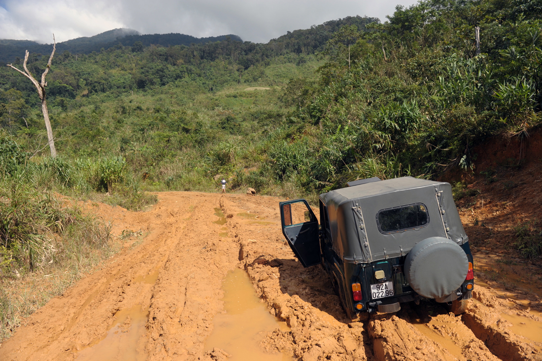
Officially, the summit of the Ngoc Linh has never been conquered. Locals and various expeditions report passing through the ginger plantations and then being pushed back by an invisible force. According to a local official, Mr. A Dieu, the cameras, electronic binoculars or GPS stop working above a certain altitude, and helicopters trying to fly over the summit are caught in turbulence (or a mysterious power) and are forced to re-route. In 2011, a Russian expedition told of strange things happening when its members went beyond the foothills of the summit forest: the sky darkened, they were hit by a tornado, and trees fell, blocking the way. The next day the expedition was lost and turned back. As soon as they reached the central valley, the weather became clement again. The Ngoc Reo, a counter-valley near the central valley, is the site of visual phenomena, with tales of the mountains moving and retreating. Adding to the mystery, the Ngoc Linh would be used for strategic purposes.
Within the framework of the research of the Last Frontiers, Secret Indochina studies the Ngoc Linh and organizes research there, especially around its maritime slopes that have been closed since 1975.