Daknong Unesco geopark - A geologic wonderland with a rich culture

Dak Nong Global Geopark is located in Dak Nong province, in the southwestern part of Vietnam’s Central Highlands at the meridional edge of the Truong Son mountain range (the Annamite Range). Extending over the five districts of Krong No, Cu Jut, Dak Mil, Dak Song, Dak G’Long and Gia Nghia town, the geopark is part of the majestic Mnong plateau with an average elevation of 600-700m above sea level; its highest point, Ta Dung, is 1,982m above sea level. On July 7, 2020, it was recognized by UNESCO as Vietnam’s third global geopark after a lengthy campaign led by Mr Ngoc Bao’s team and the Provincial People’s Committee.
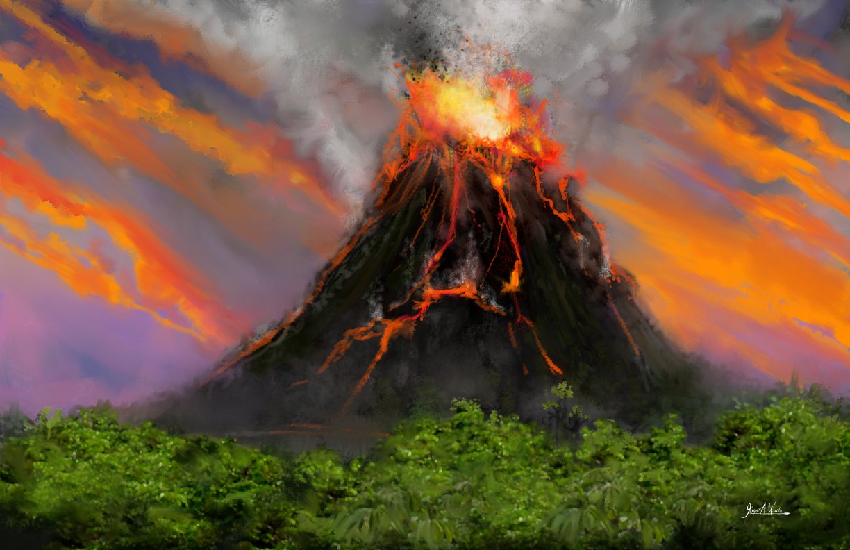
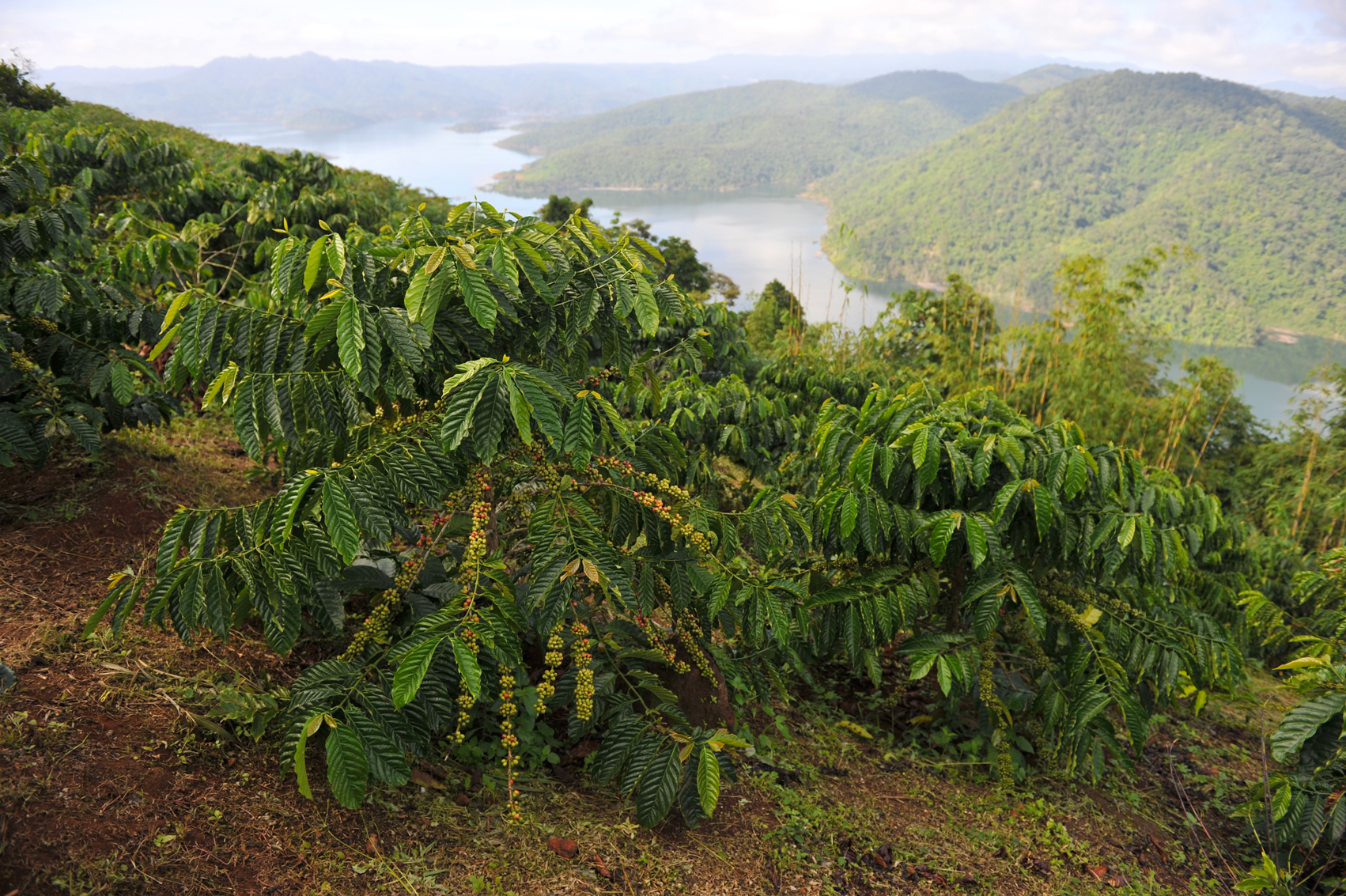
Dak Nong Geopark is distinctive in terms of geological features and geoheritage value. Part of the Gondwana ancient supercontinent 200-165 million years ago, the geopark was submerged in a passive continental margin sea rich in ammonite and bivalve fossils. Around 145-66 million years ago, this continental margin became active due to plate collision, with red-bed sediments, eruptive andesite-dacite-rhyolite, and intrusive gabbro-diorite-granodiorite-granite rocks. In the last 16.5 million years, the territory was once more active with widespread, multi-phase volcanic activities that caused a basalt cover to form over more than 50% of the geopark – creating some of the world’s largest and best quality bauxite deposits and a number of minerals such as sapphires and other semi-precious stones. It also produced fertile soil that has fed generations of locals with industrial and fruit tree crops.
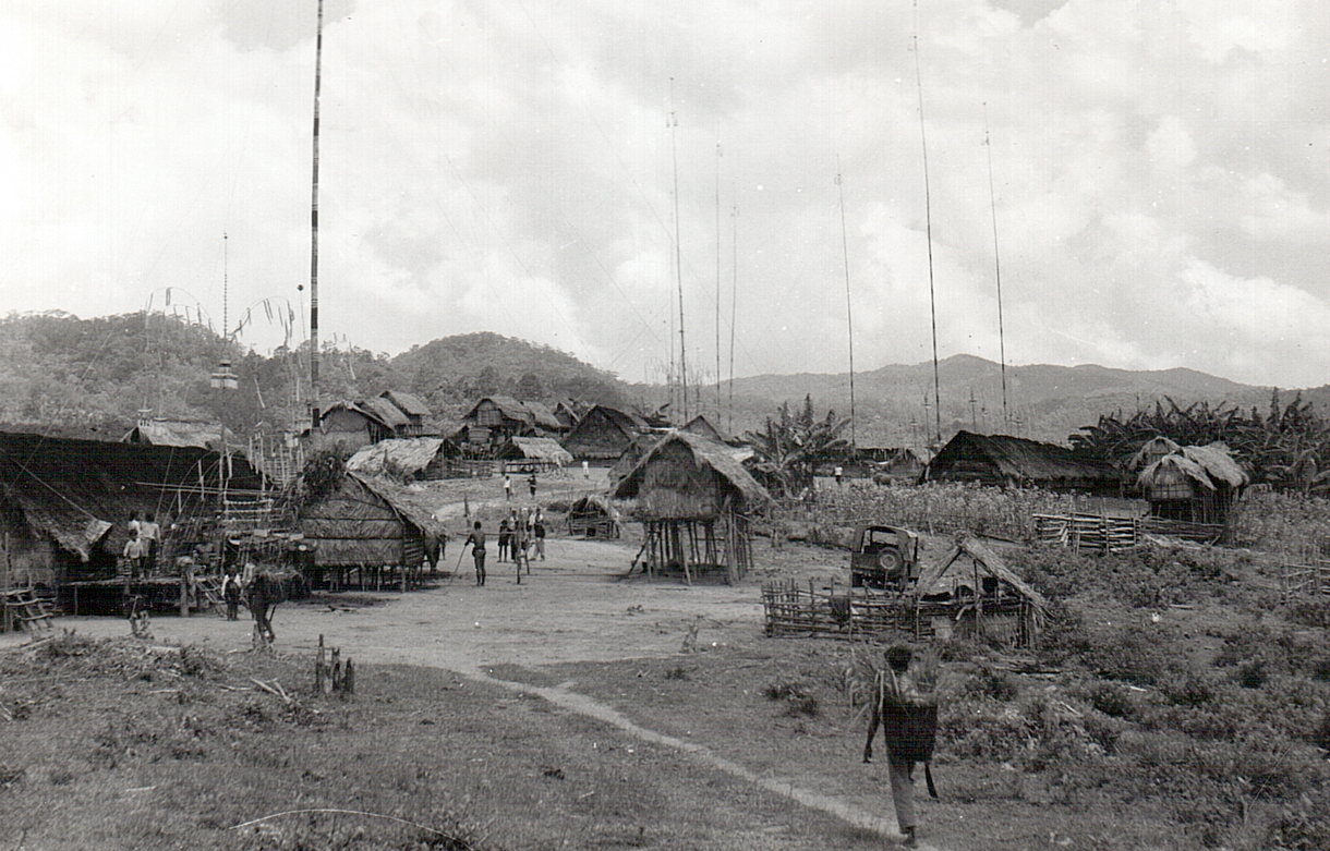
The geopark’s unique topography was shaped by young volcanic activity tens of thousands of years ago (Late Pleistocene-Holocene), resulting in spectacular craters, majestic waterfalls and one of Southeast Asia’s most extensive system of magnificent volcanic caves, which prehistoric people used as shelter around 6,000-10,000 years ago. Recent findings inside the caves included stone tools such as dish-shaped tools, short axes, blade-ground short axes, oval axes and blade-ground oval axes, flake tools, stone flakes, stone slabs, anvils, graters, pestles, hand-fitting sharp quartzite stones, and pieces of loess. Scientists also found pottery of various thicknesses, mostly fired at low temperature, with a crumbly texture made of fine sandy loam with varied patterns such as dot-dash, dotted line, dashed line, and twisted rope.

Dak Nong makes an ideal trip from either Cat Tien National Park or Lak Lak in the former Dac Lac legendary swamps. Discover the volcanic cave system in basalt rock in Dray Sap - Chu R’Luh, which the Japan Volcanic Cave Association recently recorded as the longest in Southeast Asian in terms of scale, length, and uniqueness. Explore the region’s luxuriant atmosphere through soft-adventure or adventure experience modules in Nam Nung Nature Reserve or Ta Dung National Park, ranging from half-day hiking or cycling in the direction of isolated waterfalls to two-day, one-night trips to mountain peaks. Enter intact forests famed for their biodiversity that harbor many rare species listed in Vietnam Red Book and the World’s Red Book: elephants, tigers, bison, primates (notably the Francois’ leaf monkey, or the Black-shanked douc), and elusive birds (such as the Great Hornbill and the Germain’s Peacock Pheasant). Sail along Ta Dung Lake, an enormous body of water dotted with green islands, and get to know the richness of human life in the area that is home to around 416,000 people of 40 ethnic groups, including two recognized by UNESCO as masters of gong culture (the Mnong, and the Cau Maa’ people)