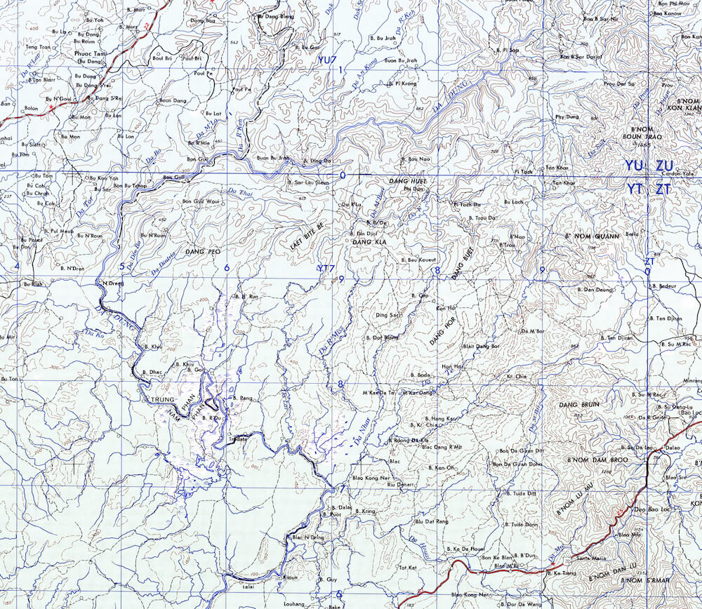
Domain area map
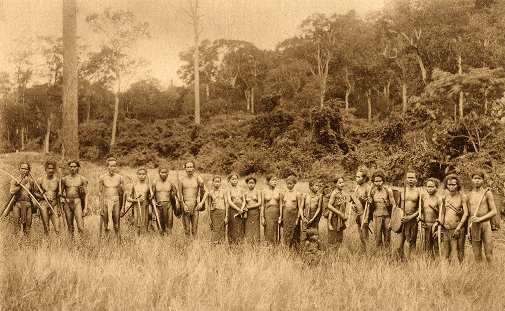
By 1952, all of French Indochina was completely explored, mapped, all resisting tribal strongholds was submitted, authoritatively controlled and administrated. All, except the heart of Cau Maa’ confederation, a rugged territory located inside the boundless loop formed by Dong Nai river (Daa’ Dööng). Only two hundred fifty kilometers north of Saigon and, paradoxically, impenetrable, impalpable and uncontrollable, the region is locally known as Nggar Maa’, Nggar Yaang, literally means the Domain of the Maa’, Domain of the genies. Since immemorial times, the Domain is sacred for the southern Proto-Indochinese groups and probably for the Proto-Chams. The jungle is considered as a genesis to the ancient gods, as a celestial residence, thus outlawed to uninitiated souls and foreigners. The land is worshiped for its exceptional forestry formations on mid-altitude basaltic soil, for its own peculiar, for some, spectacular natural wonders formerly believed to be inhabited by wood denizens and other intriguing divinities. The Maa’ Huong, a stern, impressive and unpredictable group of combatants are the consecrated guardians, devoted to protect the holy forest heart. The forest is also the residence to elephant herds, Java and Sumatra rhinoceros, abundant tigers, panthers, gaurs, bears, pythons, crocodiles and various bird species.
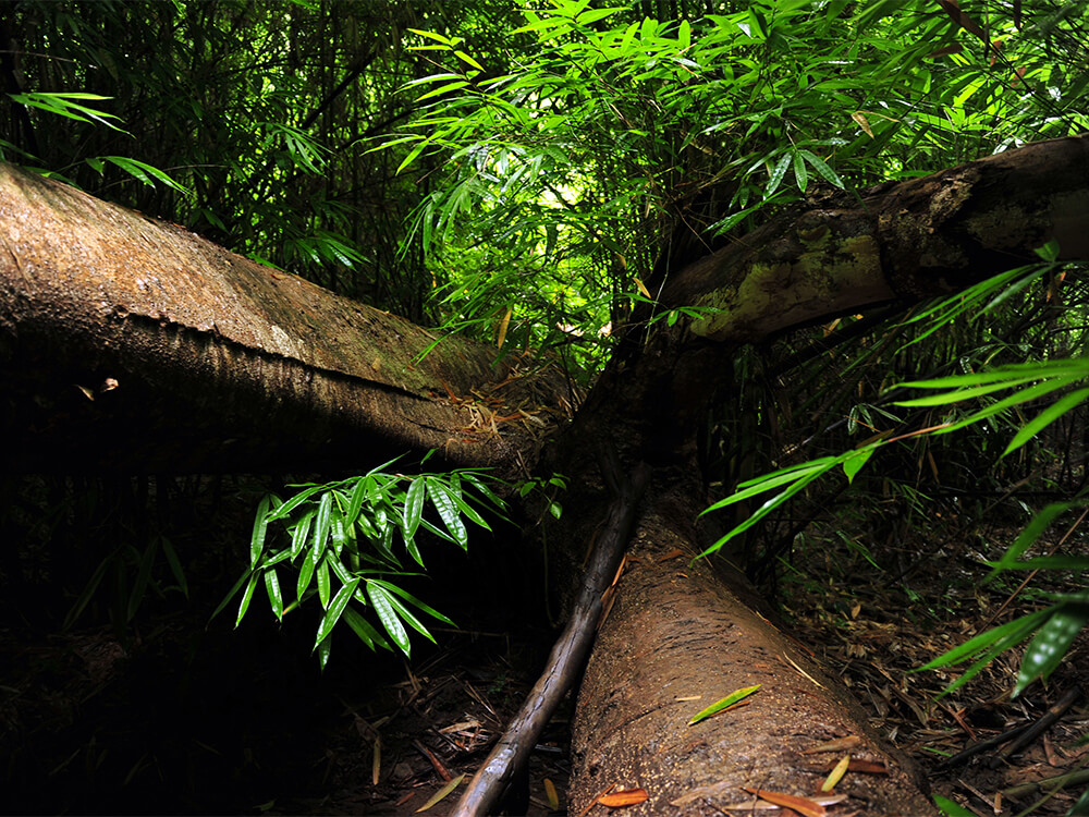
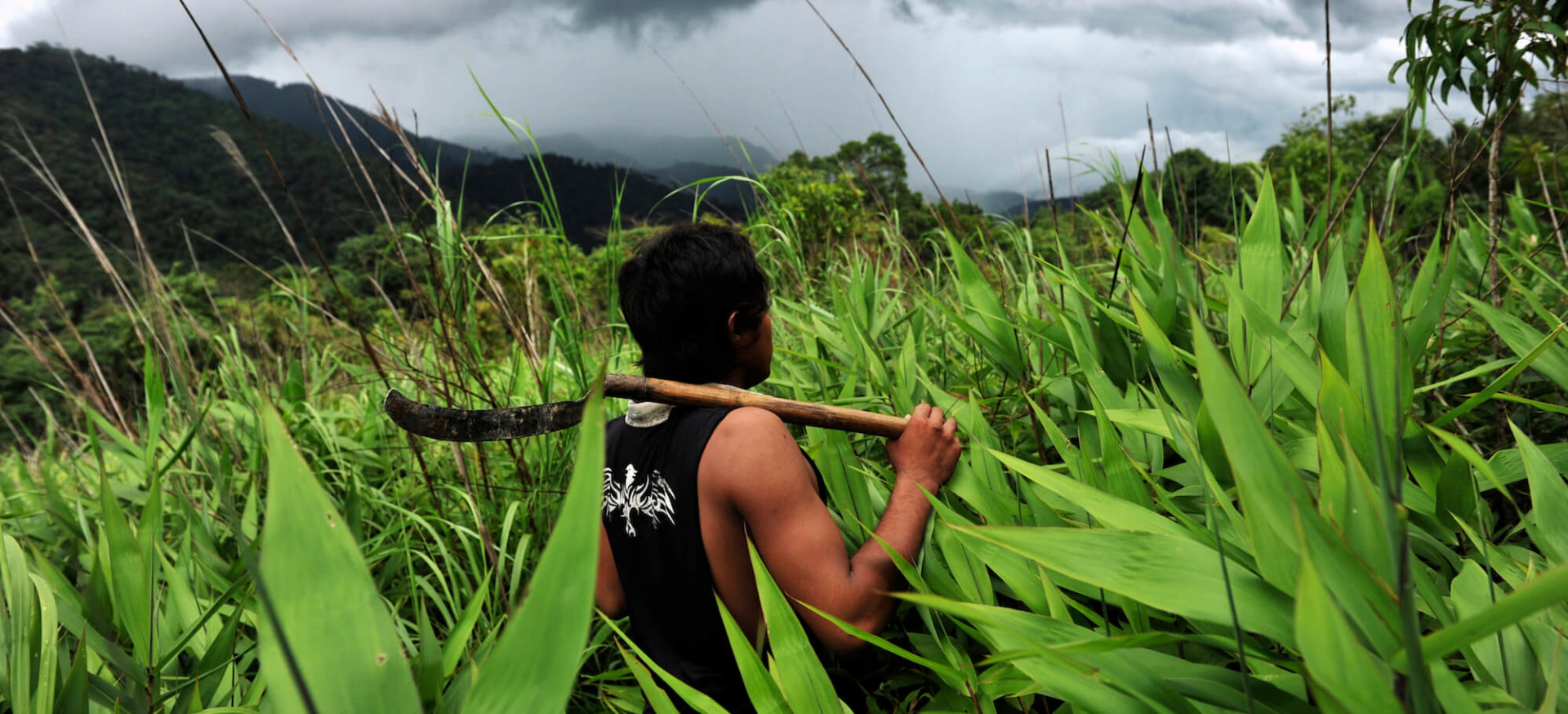
Inside the Domain
Since 1882 and Doctor Alexandre Yersin’s mission at the eastern Domain edge, all French officials’ explorations were doomed to failure, unfortunate colonial personals and their dubious companions wandered through gloomy forests, navigated on erratic waters, deepened inside endless wilderness, ambiguous solitudes secretively allied with the feared guardians, specters of ambush and slaughter. The region became a myth, named explorer’s tomb, reversed-jungle, back-jungle and rebel hinterland. In 1910, Henri Maitre organized a clandestine exploration mission, with a small escort, in a few febrile days traversing the region on a north – south axis, canoeing along Dong Nai River, thus un-allowing the guardians to have time to react. Since, all other penetration missions fail, notably the one from the Japanese’s Imperial Army. Finally, in 1952, ethnographer Jean Boulbet managed to settle a fine alliance with the Coop’s, a Cau Maa’ sub-group. He was the first foreigner allowed to enter, explore, and study the entity until 1967.
Between 1955 and 1964, the region was administrated by the South Vietnamese government, classified as Zone D. The plan was to assimilate the minorities, to dissolve local cultures and ethnic groups, to re-locate the Maa’ and other populations in strategic hamlets.
The Cau Maa' - Souther Domain area
During the Vietnam War, from 1964 to 1975, the NVA and Viet Cong used the Domain’s inaccessible woods as “maquis”, the U.S Army built an airport, a base and some sub-bases. Cau Maa’ villages, slash-and-burn fields, forests and sacred groves were instinctively bombarded by the USAF and the South Vietnamese Air Force. After 1975, the Domain was re-closed and vanished from the collective memory, as in ancient times and remained enigmatic, restricted and inaccessible until 2018.
Inside the Domain
Inside the Domain
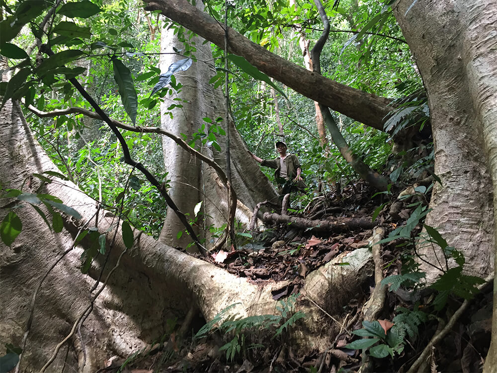
In 1997, Nicolas Vidal, vice-president of Secret Indochina, decided to re-discover the mythical forbidden jungle. After bibliographic research, principally through Henri Maitre and Jean Boulbet’s books, publications, letters, notes and maps, between 2007 and 2014 he completed several pre-surveys in order to study the region, to localize the Domain’s center and to identify possible access.
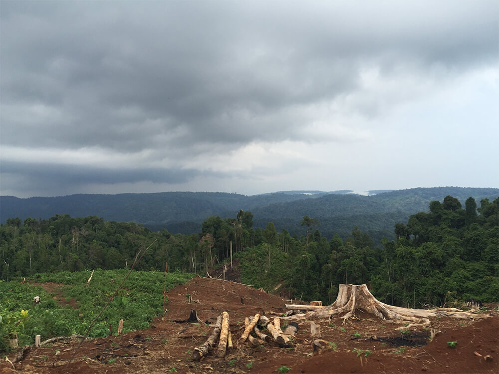
Since the end of the Vietnam War, the Domain has experienced various degrees of degradation, more than 60% of the original surface, land and forests have been deforested, devastated, replaced by cafés, cashew and rubber plantations or rice fields; savannas, swamps and rhinoceros have disappeared, as well as most of the local fauna, some Cau Maa’ clans, villages and hamlets have vanished or been re-located. Fortunately, two areas remain miraculously untouched in the south-west of Thon 5A (Dang Pör – Haut Intégral) and around the two central meadows (Ddang Yaang – the Spirit Ridge), forming an ensemble constituted by sinuous ridges, high meadows, shadowing narrow vales, ancestral groves, primeval forests shreds, seas of bamboo forests, solitary ponds, dark ravines and meandering streams.
Southern Domain edge
Between 2015 and 2018, in collaboration with Francois Bouvery Olivier Roy, the local and the Cat Tien National Park, four official missions were organized in the two central meadows area. In May 2015, the first mission approached the Daa Lai river, the American airport, Thon 5A, the two central meadows and the Dragon swamp (Rduuny). In April 2016, a second mission surveyed the western part of the central meadow, towards the Tiger mount (Ddang Klaa). In February 2017, a third mission surveyed the eastern part of the central meadow, then along Daa Koo river ravines. In April 2018, a fourth mission surveyed the upper Daa Nggar river and the Tiger meadow, northeasternwards.